Price range: $10.00 through $65.00
This product adds our extensive routing ATV trail map data to OsmAnd, the most fully functional GPS mapping app for android tablets and smart phones. The free OsmAnd app available in the Google Play store provides loads of useful features for navigation and trip planning. Our trail map adds precise turn by turn routing on ATV trails, displays color coded trails, trail names, searchable map points for on-trail services and more.
With our new Ala-cart ordering you can order individual state maps, update previous purchases, or get the built-in discount by ordering multiple state map at one time.
Description
These ATV Trail Maps use our high resolution routing ATV trail map data to plug into OsmAnd, the most fully functional GPS mapping app for android and Apple tablets and smart phones. The free OsmAnd app available in the Google Play store and the Apple App Store provides loads of useful features for navigation and trip planning. Our trail map adds precise turn by turn routing on ATV trails, displays color coded trails, trail names, searchable map points for on-trail services and more.
All the ATV Trail Maps and background maps you need can be stored on your phone or tablet, so there is no worry in the deep back woods where no data signal is available.
Watch a quick video of the App here…
View the install instructions on Android Phones and tablets here…
*View the install instructions on Apple iPhones and iPads here…
*Note – in the Apple install notes references to SNOW should be substituted with ATV.
Plug our map data into the OsmAnd app and watch it shine as am ATV or UTV trail navigator.
Here is what is included in our downloads.
- Extremely high resolution vector maps show every nuance and curve of the trails.
- Two vector map styles, one 5 color using color to indicate trail types. One cyan color for maximum contrast over dark map backgrounds. This is in addition to several standard OsmAnd vector map styles.
- Optional state transparent raster overlay maps, including trail names and POI icons.
- POI’s (Points of interest) for gas, food, lodging, intersections, scenic outlooks, and attractions.
- Detailed POI descriptions for gas food and Lodging, includes phone numbers, web site and street addressed.
 \
\
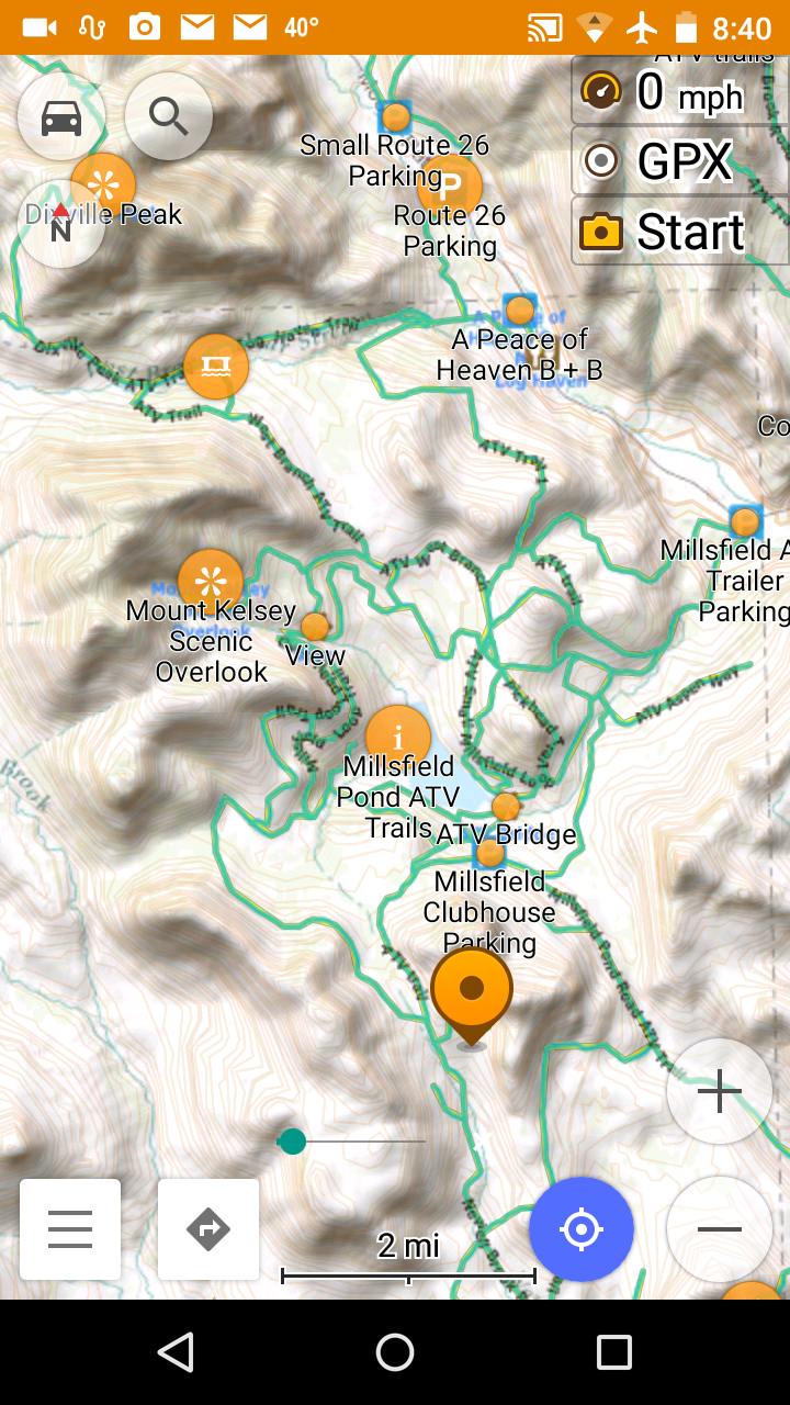
ATV routing vector trails with Online trail tiles overlaid over ERSI Topographical map underlay. Clickable POI map points displayed.
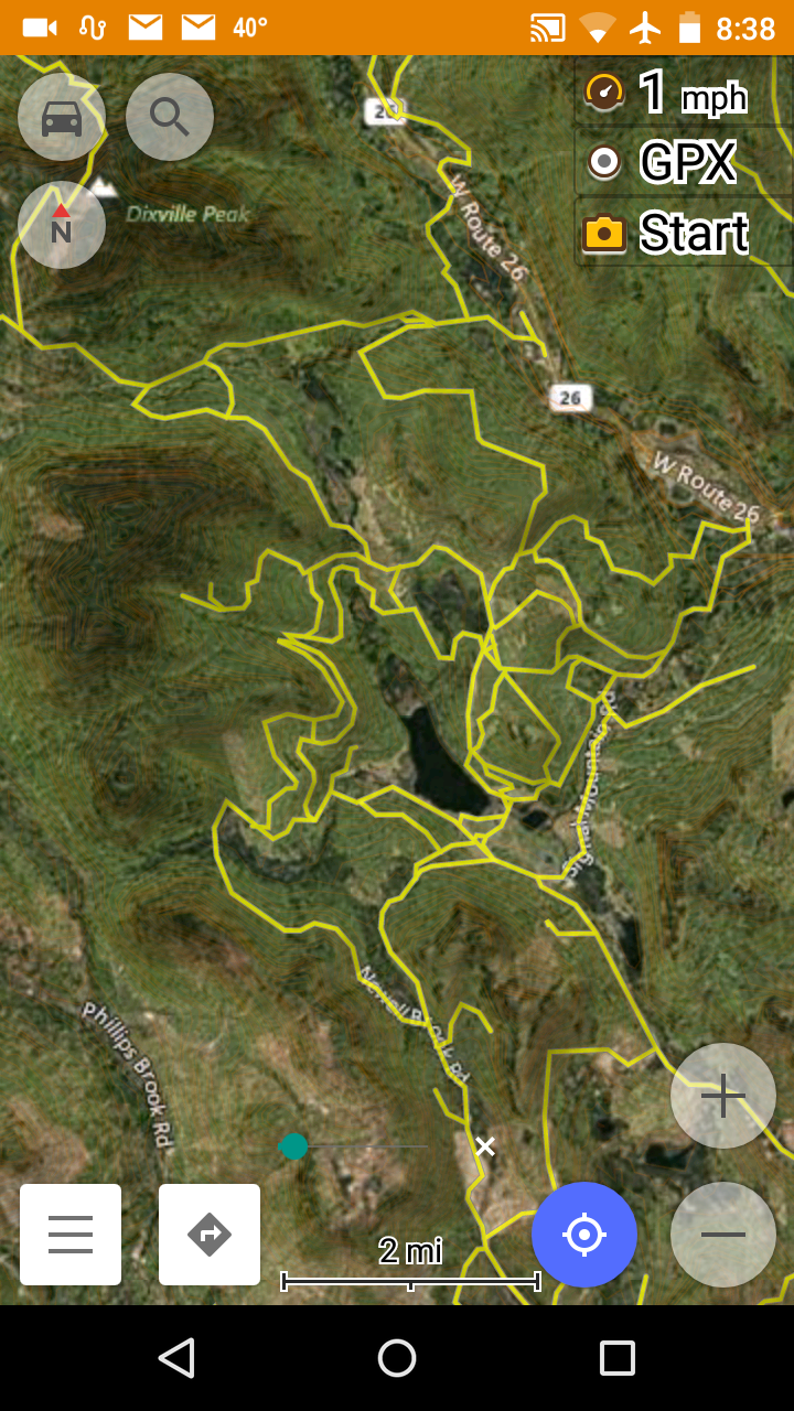
5 Color Vector Style trails over a Microsoft Hybrid high resolution satellite tiled underlay map.
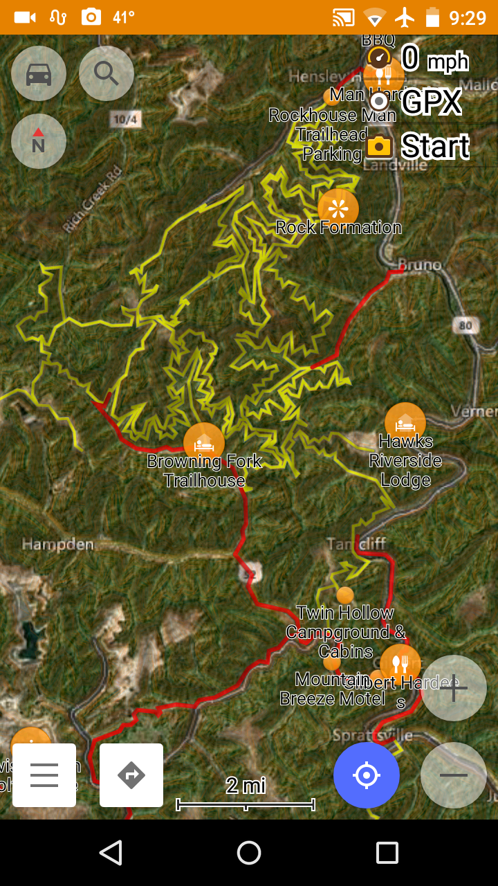
West Virginia map with 5 Color vector map style over Microsoft Hybrid satellite image underly, POI display enabled. Red are “outlaw” connector trails, yellow are Rockhouse trail system..
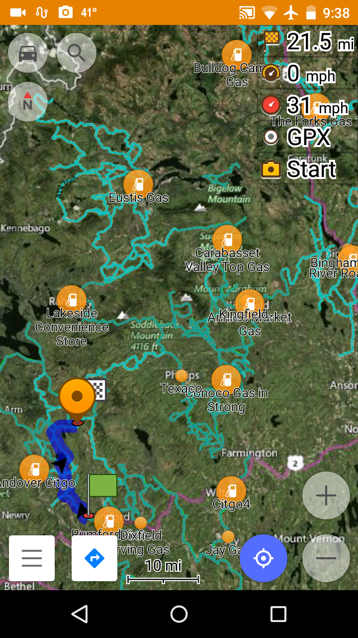
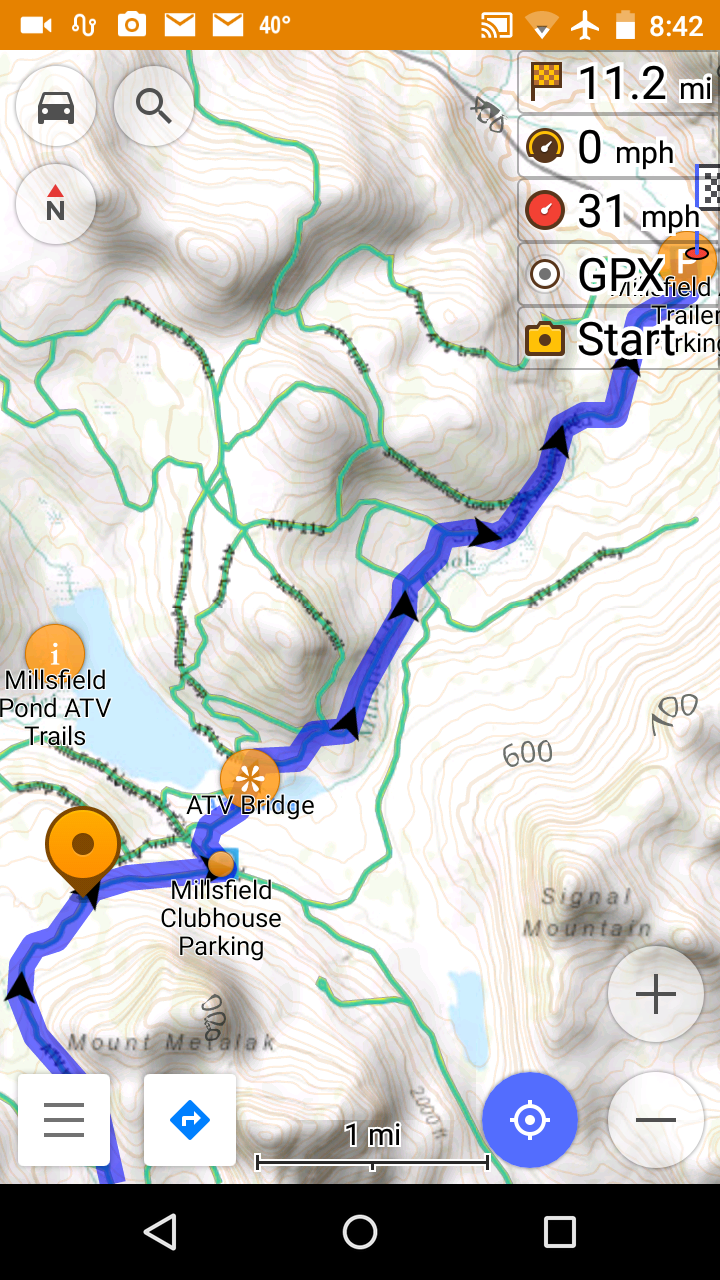
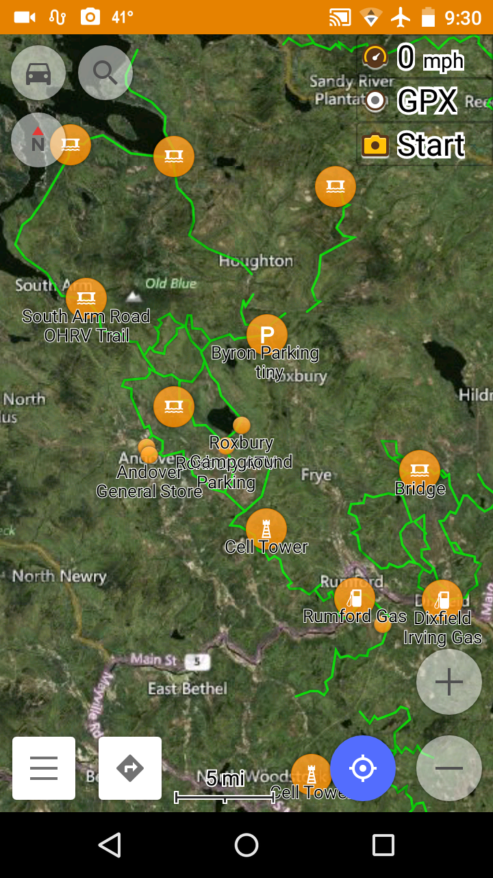
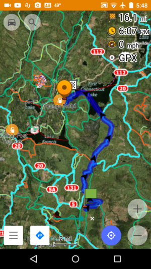
Maine trail map tiled overlay, POI type Gas enabled, over a Microsoft Hybrid satellite tile underlay map. Calculated route in blue.
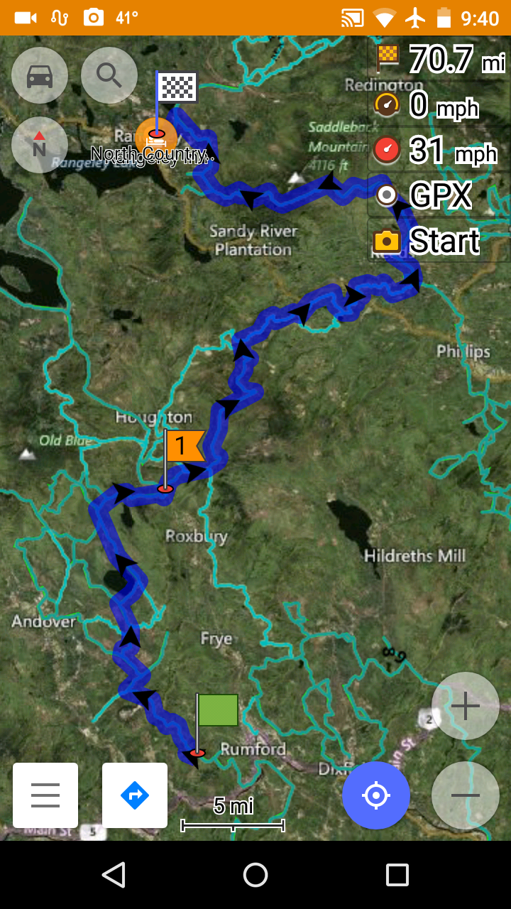
Multi-point route (dark blue), Maine tiled overlay (cyan color) over Microsoft Hybrid satellite imagery.
Dashboard view of multi-point route. above.
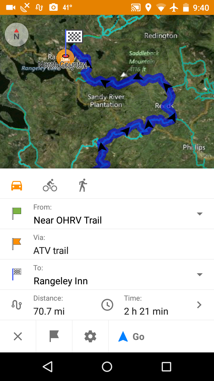
Turn by turn list for a calculated route. Spoken with TTS speech files installed. List can be printed.
5 Color style green vector trails represent OHRV trails in Maine. UTV’s no wider than 60″ and trail bikes can legally ride these trails. UTV and Trail bike riders can avoid being routed on ATV-Only trails by setting navigational preferences to AVOID TOLL ROADS..
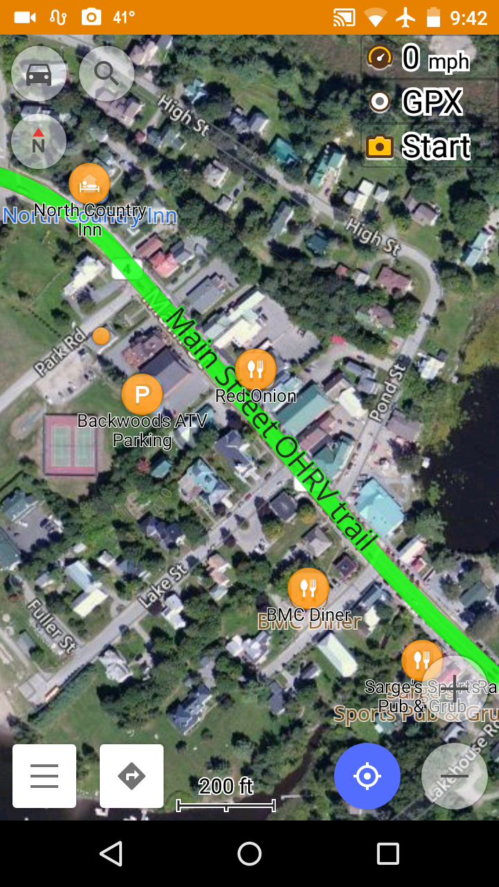
Zoomed in at 200ft level. Rangeley Maine.
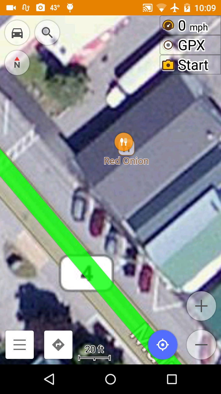
Extreme zoom into Microsoft Hybrid maps and vector trails. The Red Onion restaurant in Rangely Maine. Is that your red Mazda in the parking lot?
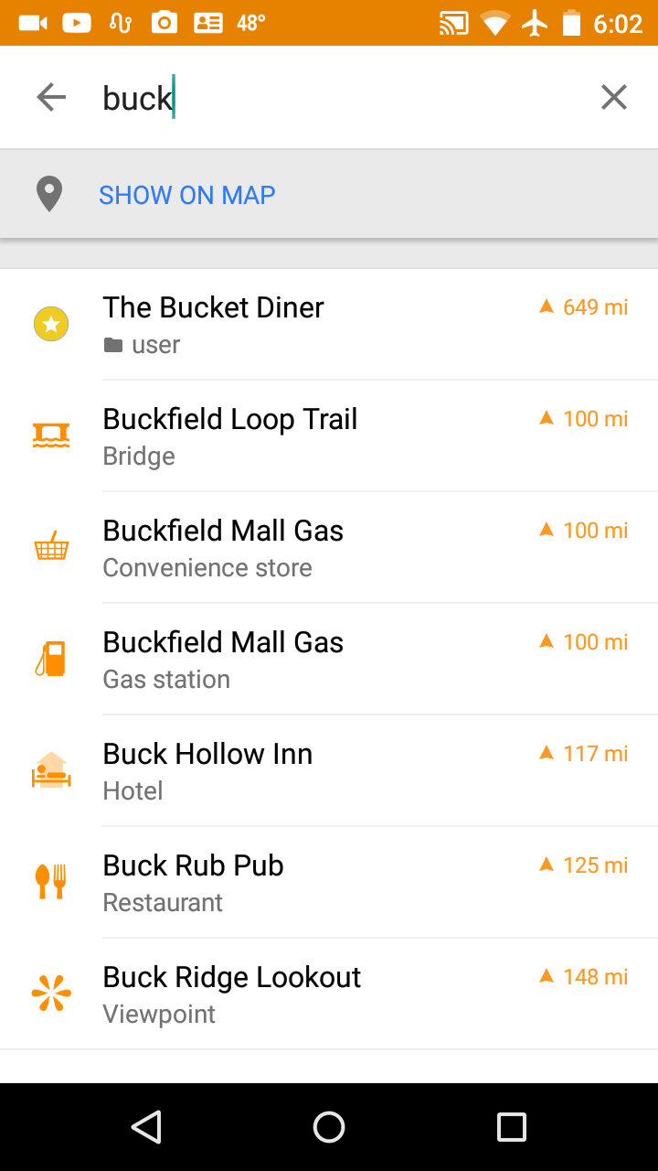
Search map points (POIs) by name, category or distance.
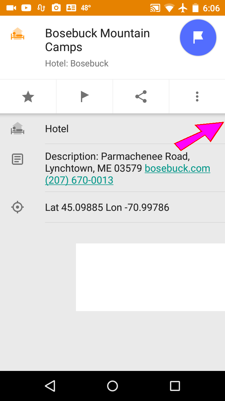
Just click on a phone number to initiate a call.
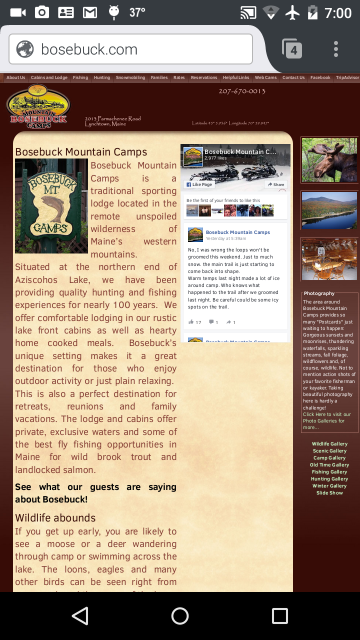
Click on a web site URL to open that page.
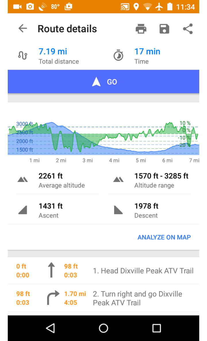
Elevation and slope graphs available along a calculated route. Click here for a more detailed description of this new feature.
Scroll and zoom to preview the map data on the interactive display below
Use the search box to find addresses, GPS coordinates etc.
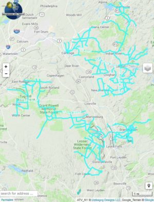
You can select from several trail systems including New Hampshire , Maine, Vermont , Lewis County New York, West Virginia and most recently Michigan.
Includes these trail systems (and more)
West Virginia Trails

![]()


 Map includes all of the Hatfield McCoy Trail systems, community connector trails in the towns of Williamson, Delbarton, Logan, and Gilbert. The map also includes loads of outlaw trails in towns like War, Welch, McComas, Pineville, Mullens, Matoaka, Crumpler, Northfork, Matewan, Cherokee, Bramwell. East Lynn and more. CAUTION: This map does not give you permission to do anything, so know the local laws and trail systems rules before riding on ummarked outlaw trails.
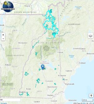
New Hampshire Trails
New Hampshires greatest attraction is the “Ride The Wilds” trail system in the northernmost county of Coos. These trails abut the scenic White Mountains and include connector trails that allow you to ride from one club system to the next and to in-town services for gas good and lodging. Systems include the Jericho State Park and Berlin NH, Great North Woods Riders in Pittsburg, NH, 


Maine Trails
 Maine is huge state covered in ATV UTV and trailbike trails, in northern “country”, downeast_coast , western mountains, and central.
Michigan Trails
![]() Explore Michigan‘s extensive ATV, ORV and MTTC Trail Bike system with our maps. Explore the far northern UP trails, the Lake Superior State Forest – Newberry Unit, or look for wildlife and waterfalls in the Ottawa National Forest. Checkout the variety of terrain on Drummond Island Trails.
Explore Michigan‘s extensive ATV, ORV and MTTC Trail Bike system with our maps. Explore the far northern UP trails, the Lake Superior State Forest – Newberry Unit, or look for wildlife and waterfalls in the Ottawa National Forest. Checkout the variety of terrain on Drummond Island Trails.
Related products
-
NY ATV Map for Garmin
Price range: $15.00 through $35.00 Select options This product has multiple variants. The options may be chosen on the product page -
NH ME WV ATV Map for Garmin
Price range: $60.00 through $80.00 Select options This product has multiple variants. The options may be chosen on the product page -
NH ATV Map for Garmin
Price range: $20.00 through $40.00 Select options This product has multiple variants. The options may be chosen on the product page -
Snowmobile Maps for OsmAnd on Android & Apple
Price range: $20.00 through $80.00 View products