
Price range: $30.00 through $50.00
Michigan ATV, ORV and Trail Bike Trail Map for Garmin GPS
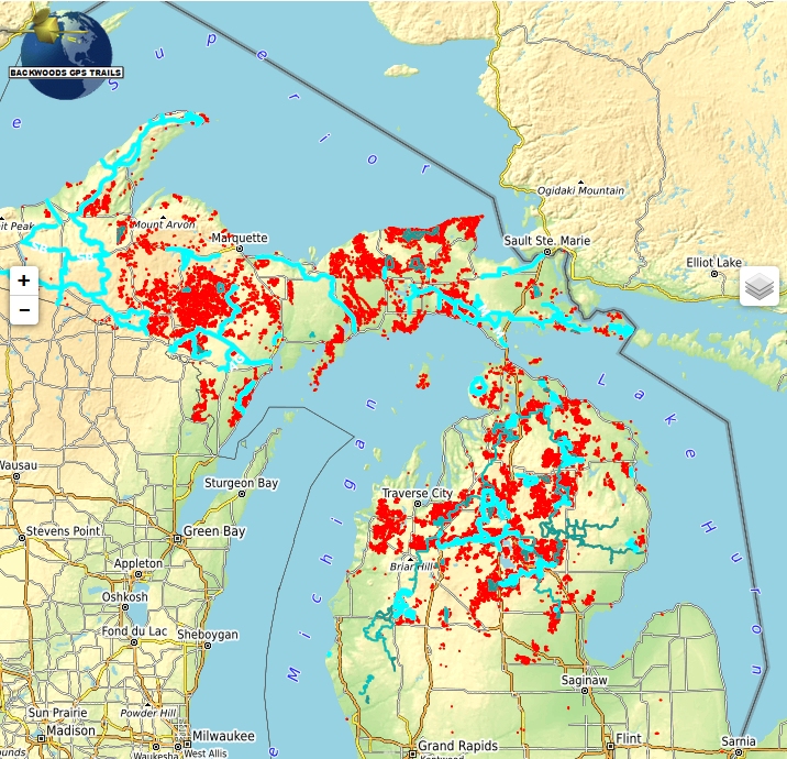
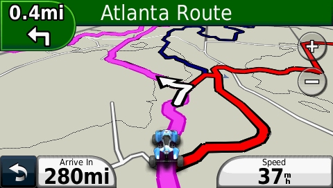
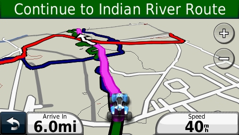
This routing ATV trail map covers over 4080 miles of legal ATV, ORV and Trail Bike trails in Michigan. In addition, we have added over 7600 miles of DNR Forest roads that are open to ORV use. This map routes you along trails to your destination with spoken turn by turn directions, visual and audible indications of turns, lists of turn by turn directions, estimated time of arrival (ETA), detouring, route avoidances and precise distance to destination calculations. Includes POIs for campgrounds, hotels, gas stations and convenience stores, most with addresses, phone numbers and web site links.
Description
Browse the interactive map below to preview the map content
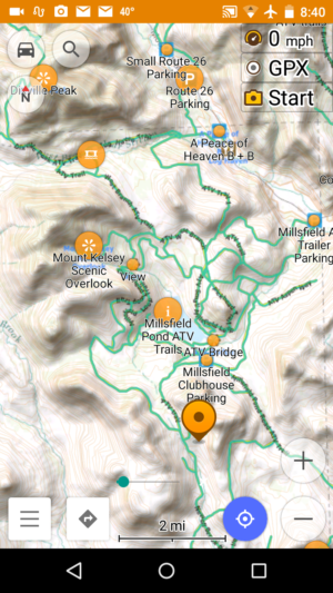
This Michigan ATV trail map helps you explore Michigan‘s extensive ATV, ORV and MTTC Trail Bike system with our maps. Explore the far northern UP trails, the Lake Superior State Forest – Newberry Unit, or look for wildlife and waterfalls in the Ottawa National Forest. Checkout the variety of terrain on Drummond Island Trails.
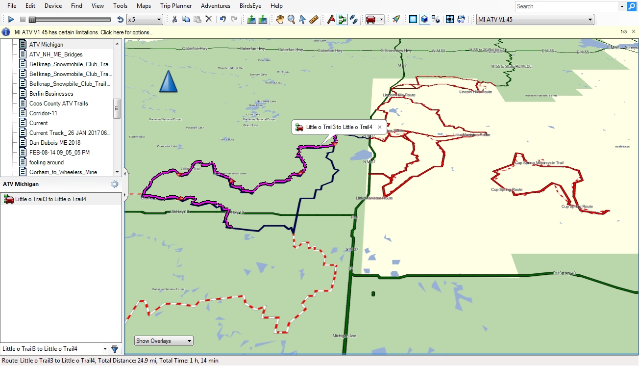
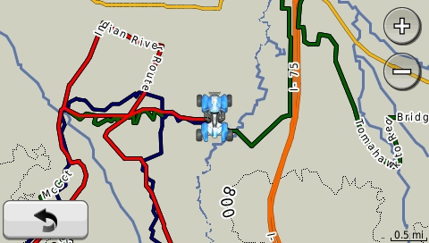
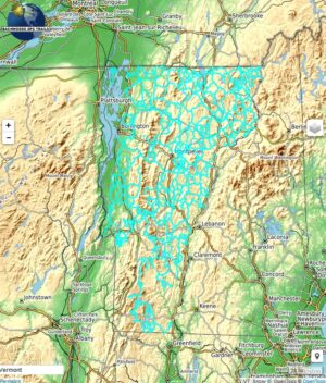
What you see in the map display above illustrates the trails and searchable map points included in the product. This product includes a Garmin format map that includes ATV, OHV, Trail Bike trails, DNR Forest roads open to ORVs. Also includes map points for Parking, Lodging, Restaurants, and Gas, an installation program to install the map onto your Windows PC or Macintosh computer. The colors of trails are not replicated here exactly as it will appear on your GPS. Trail names are displayed on your GPS. To evaluate the map, scroll around the map to different areas. Zoom in close to view how precisely the trails follow the underlying logging roads and paths that are used for trail riding. Our online map may be a few versions behind the product version. The trail map product does not include background maps and overlays (terrain, roads, satellite images, snow depth, weather and radar) shown on the map display above. A separately selectable topographic map is included for use as a background map on your GPS. Various backgrounds are displayed here merely to give you context of where the Trails and POI’s are located and to allow you to evaluate the trail map trails and map points. The trail map is transparent, and can be superimposed over the base map(s) and/or shaded relief map built into your GPS firmware, as well as most Garmin and third party maps. See Trail Map Features for additional information.
Additional information
| Media Options | Download ZIP format, Pre-loaded micro-sd card |
|---|
Related products
-
NH ATV Map for Garmin
Price range: $20.00 through $40.00 Select options This product has multiple variants. The options may be chosen on the product page -
NH ME VT & NY Snowmobile Trail Map for Garmin
Price range: $65.00 through $85.00 Select options This product has multiple variants. The options may be chosen on the product page -
ATV Maps for OsmAnd on Android & Apple
Price range: $10.00 through $65.00 View products -
VT Snowmobile Trail Map for Garmin
Price range: $25.00 through $45.00 Select options This product has multiple variants. The options may be chosen on the product page