
$60.00 – $80.00
This routing ATV trail map covers over 8932 miles of ATV, UTV and trail bike trails in New Hampshire (996), Maine (5083) and West Virginia (2854). This map routes you along trails to your destination with spoken turn by turn directions, visual and audible indications of turns, lists of turn by turn directions, estimated time of arrival (ETA), detouring, route avoidances and precise distance to destination calculations.
Description
Browse the interactive map below to preview the map content
Includes these trail systems
This map covers a wide geographic area in New Hampshire, Maine and West Virginia so to evaluate the map you really need to scroll and zoom into the various areas of the map to really appreciate how extensive and detailed the map is. (click icons and links below to zoom the interactive map (above) to that trail system)
West Virginia Trails

![]()


 Map includes all of the Hatfield McCoy Trail systems, community connector trails in the towns of Williamson, Delbarton, Logan, and Gilbert. The map also includes loads of outlaw trails in towns like War, Welch, McComas, Pineville, Mullens, Matoaka, Crumpler. Northfork, Gilbert, Matewan, Cherokee, Bramwell. East Lynn and more. CAUTION: This map does not give you permission to do anything, so know the local laws and trail systems rules before riding on ummarked outlaw trails.
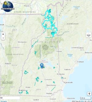
New Hampshire Trails
New Hampshires greatest attraction is the “Ride The Wilds” trail system in the northernmost county of Coos. These trails abut the scenic White Mountains and include connector trails that allow you to ride from one club system to the next and to in-town services for gas good and lodging. Systems include the Jericho State Park and Berlin NH, , 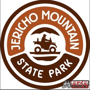


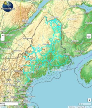
Maine Trails
 Maine is huge state covered in ATV UTV and trailbike trails, in northern “country”, downeast_coast , western mountains, and central.
What you see in the map display above illustrates the trails and searchable map points included in the product. This product includes a Garmin format map that includes ATV and OHRV (Trail bike and UTV) trails and map points, an installation procedure to install the map onto your Windows PC or Macintosh computer. The colors of trails are not replicated here exactly as it will appear on your GPS. Trail names are displayed on your GPS. To evaluate the map, scroll around the map to different areas. Zoom in close to view how precisely the trails follow the underlying logging roads and paths that are used for trail riding. Trails marked with ~ symbol in the name are approximated trails. The trail map product does not include background maps and overlays (terrain, roads, satellite images) shown on the map display above. A separately selectable topographic map is included for use as a background map on your GPS. Various backgrounds are displayed here merely to give you context of where the Trails and POI’s are located and to allow you to evaluate the accuracy and precision of trail map trails and map points. The “Search for Address” feature is not provided, but a similar find feature (Where To? or Find) is built into your GPS. The trail map is transparent, and can be superimposed over the base map(s) and/or shaded relief map built into your GPS firmware, as well as most Garmin and third party maps.
See Trail Map Features for additional information.
Additional information
| Media Options | Download ZIP format, Pre-loaded micro-sd card |
|---|